![]() Ця сторінка також доступна українською.
Ця сторінка також доступна українською.
Introduction
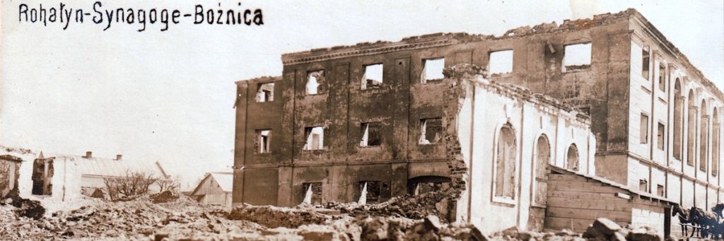
Rohatyn’s heavily-damaged Great Synagogue in a WWI-era postcard. Source: Dennis Blum donation to the Rohatyn Opillya museum.
After more than three centuries of vibrant Jewish life, there is no Jewish community in Rohatyn today, and there are no consecrated Jewish prayer houses or other buildings retaining their original use for assembly, ritual purification, or religious instruction. Absent a Jewish presence after World War II, the few synagogues, bath houses, schools, and other community buildings which were not destroyed during the German occupation and the Holocaust were repurposed to non-Jewish secular uses under post-war Soviet administrations, and most of those buildings later fell into disrepair or were leveled. Locating where in Rohatyn the lost community buildings once stood is difficult, as relevant Jewish and municipal records from before the war are scarce.
However, one can still walk around the town center to view the few surviving buildings, and standing among the houses and buildings of the concentrated former “Jewish quarter” still gives a sense of the impressive collection of synagogues and other Jewish community buildings which once stood there. On this page we will describe individual buildings first, before discussing the collection of less-documented assembly halls and other buildings. Here are the Jewish community buildings in Rohatyn known today:
- the main or “great” synagogue (destroyed): 49.4114N, 24.6100E (49°24’41.2″N 24°36’36.1″E)
- a large beit midrash (ruin): 49.4112N, 24.6100E (49°24’40.4″N 24°36’35.8″E)
- a small synagogue or cheder (ruin): 49.4111N, 24.6102E (49°24’40.0″N 24°36’36.9″E)
- the western synagogue and mikveh (repurposed): 49.4094N, 24.6079E (49°24’33.8″N 24°36’28.4″E)
- a bath house and Hebrew language school (repurposed): 49.4095N, 24.6060E (49°24’34.1″N 24°36’21.4″E)
We agree with others that built religious heritage can and should have value for future generations. Rohatyn Jewish Heritage currently conducts a documentation project which aims to research, assemble, and publicize records, photographs, and informal information from local sources, including interviews with Rohatyn residents, as well as data and documents from heritage researchers in Ukraine and abroad.
Read about the Synagogues Documentation Project
This article is part of a series on Rohatyn’s Jewish heritage on this website. To view the community buildings as part of the broader Jewish heritage of the town and the district, see this modern interactive map of the heritage sites.
Rohatyn’s Great Synagogue (Valova Street – destroyed)
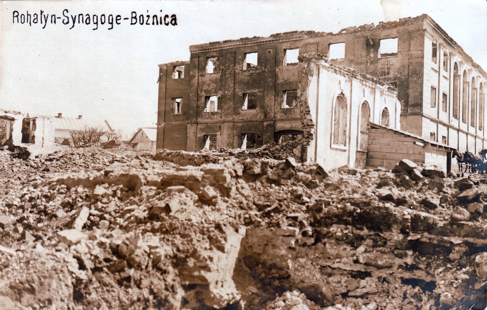
A WWI-era postcard of Valova Street in Rohatyn, with the heavily-damaged Great Synagogue at right. Source: Tomasz Wiśniewski Collection.
Based on published histories of Rohatyn which describe the early-modern town as “walled” (with walls made of earth and other materials), and surviving evidence of the ancient walls in a few places around town including the existing street named “vulytsia Valova” (Wall Street), it is likely that the original Jewish community of Rohatyn assembled around a cluster of synagogues and other buildings built just south of modern Valova street, a short walk north of the main town square. On the 1846 cadastral map of Rohatyn one can see several buildings labeled “synagogue”, including one which is relatively large, though made of wood (the yellow color on the historical map). Before World War I, this wooden house of worship was replaced with a very large, three-story brick structure which was known to the local community as the “Great” Synagogue; it must have served a significant portion of the religiously-observant Jewish men and women of Rohatyn, and dominated the dense neighborhood in which it stood.
Unfortunately, there are no known photographs or drawings of the Great Synagogue in its intact state. The architecture of Rohatyn was heavily photographed during and after World War I to illustrate the shocking damage to the buildings and roads of the town, which was partly due to front-line battles and partly due to sabotage by the retreating Russian imperial army, especially in 1915. A number of postcards, military photographs, and other images of Rohatyn show the damaged Jewish quarter and especially the burned and roofless Great Synagogue. One image from around 1919~1920 included in the Yizkor Book for Rohatyn shows work in progress to clear and prepare the synagogue for rebuilding during the interwar period.
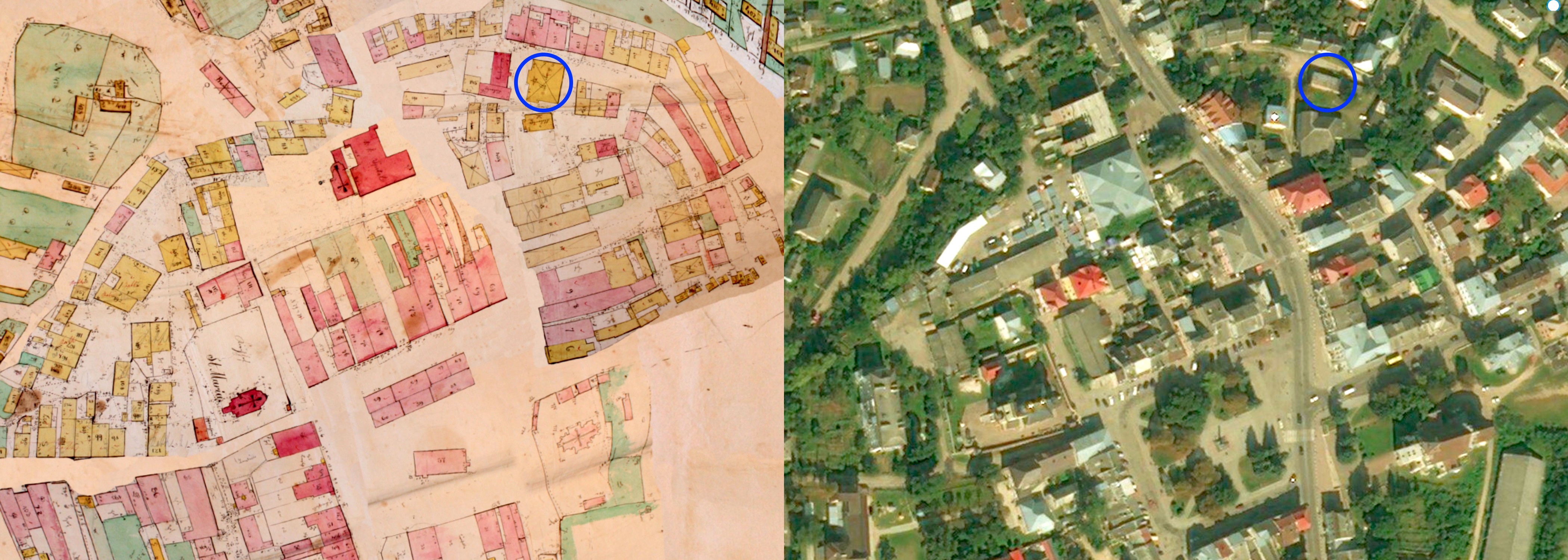
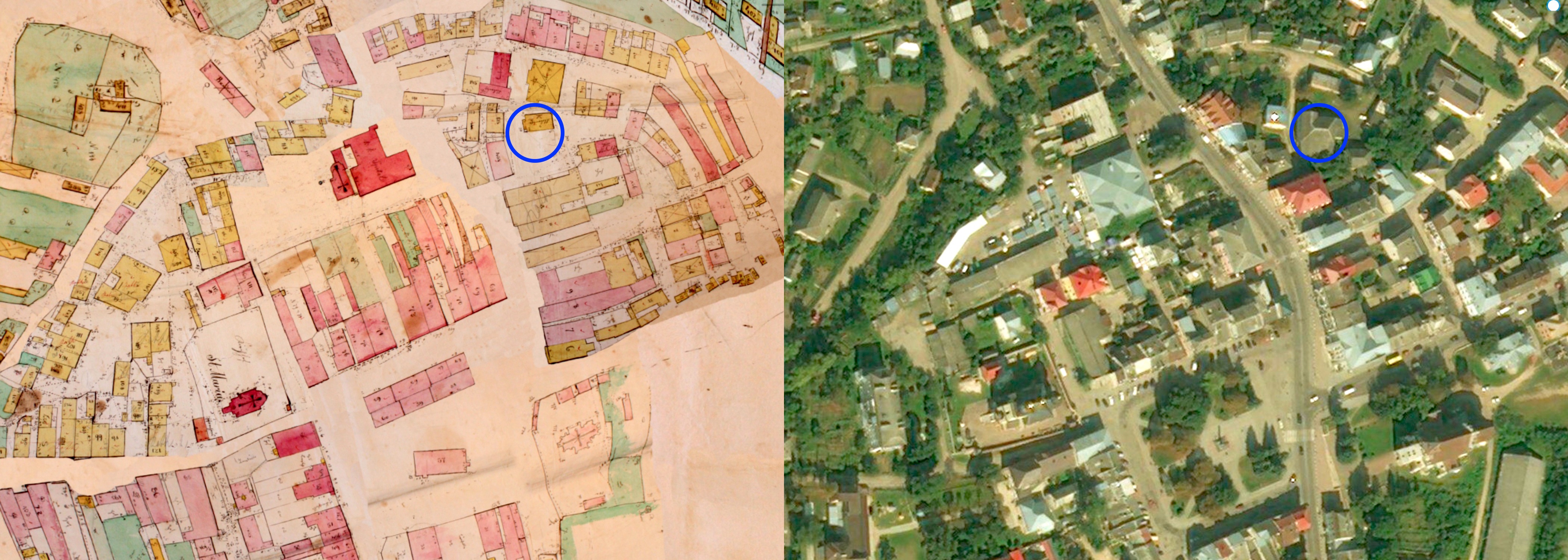
The Great Synagogue (blue circle) located on an 1846 cadastral sketch of Rohatyn, and on a modern satellite image with the same bounds.
Historical map courtesy of Gesher Galicia; satellite view © 2019 Microsoft Corporation, DigitalGlobe, and CNES.
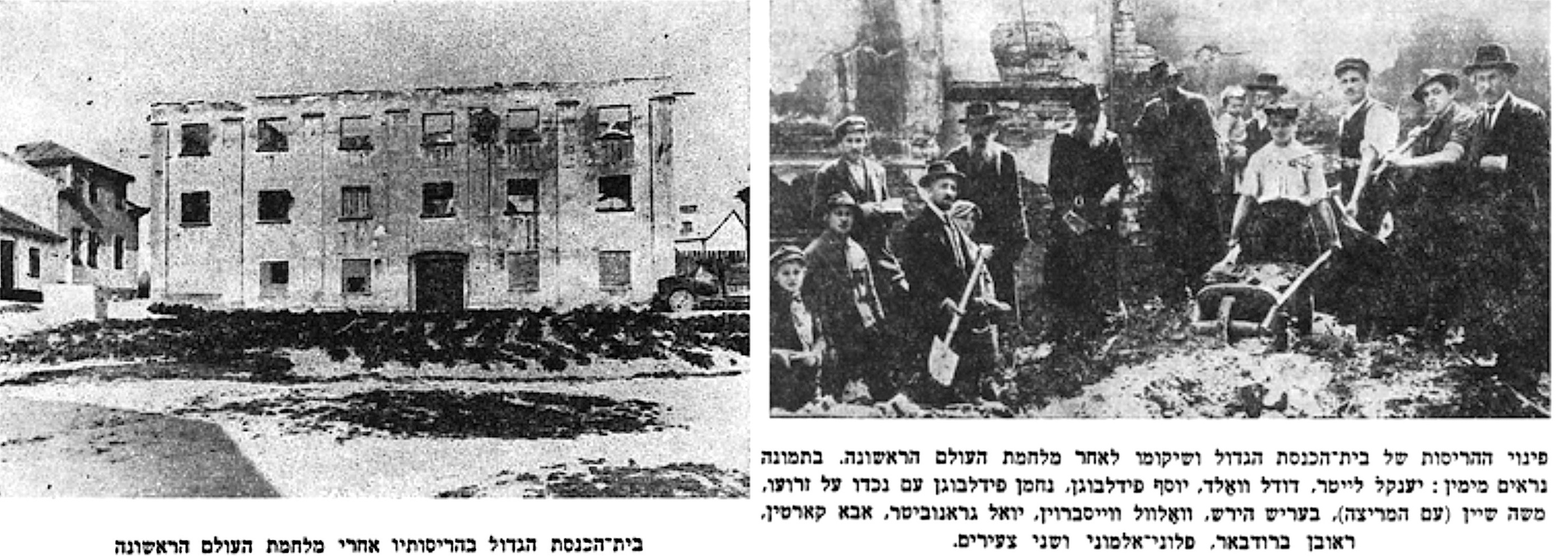
Two views of the Great Synagogue from the Rohatyn Yizkor Book: WWI damage (p.105) and interwar repair work (p.119).
As was true for many significant Jewish prayer houses throughout Poland and western Ukraine, Rohatyn’s Great Synagogue stood as witness to harassment and worse of the Jewish community in 1941. Then, after Jews were forced into the ghetto that same year, the Great Synagogue and other community buildings not re-purposed as stables or storage were destroyed by the occupying German forces. The ruins were eventually cleared from the site during post-war urban reconstruction under the Soviet regime. A single cornerstone rumored to be from the Great Synagogue remains at the site, where today there is a roughly-built storage shed covering a portion of the footprint of the former building.
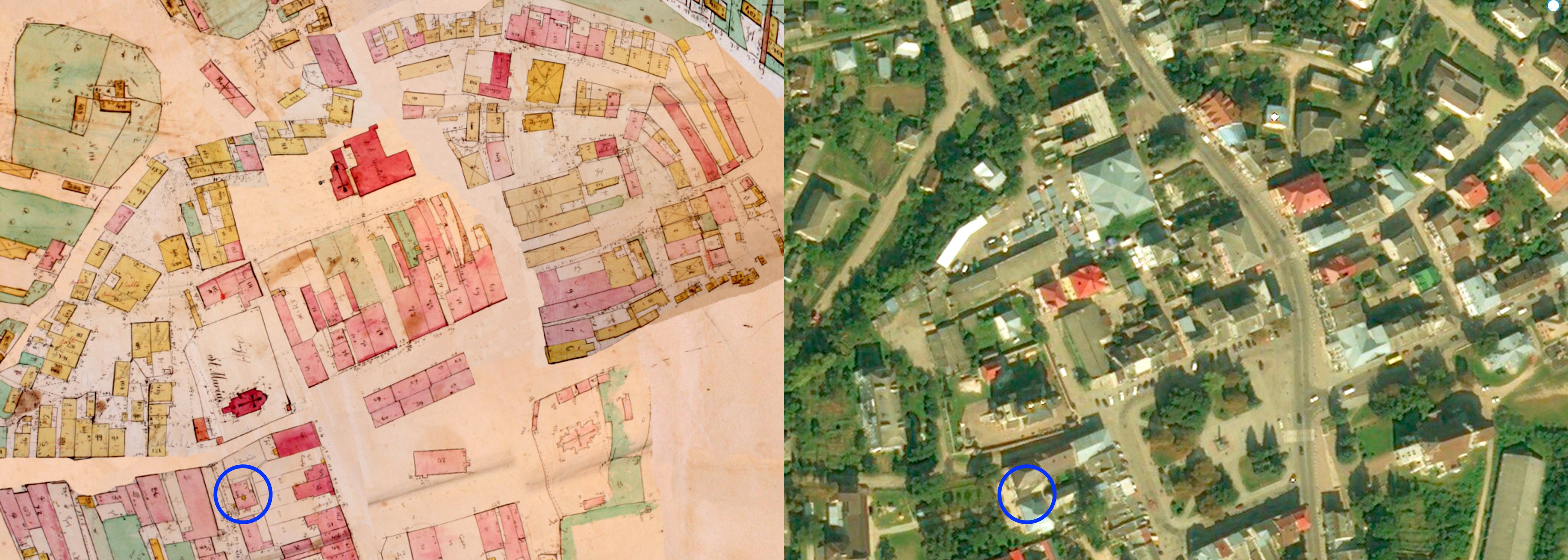
A Large Beit Midrash (Valova Street – ruin)
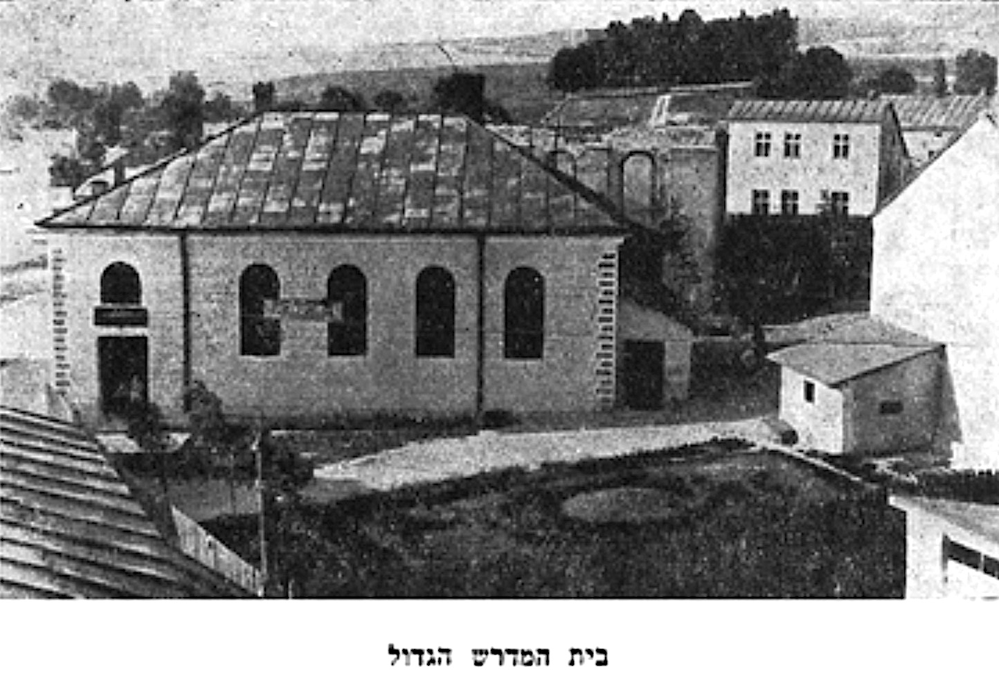
A view of the main beit midrash in Rohatyn’s old Jewish quarter, from the Rohatyn Yizkor Book (p.106).
Another significant former Jewish structure which survives in Rohatyn is a large but damaged building in the former synagogue complex on Valova Street northeast of the town square. We believe this building was a beit midrash (religious study hall) and/or possibly a synagogue before World War II; it has been variously documented as serving one purpose or the other, and may have served both. As seen on the 1846 cadastral map of Rohatyn and the satellite view below, a wooden structure was present on the site in the 19th century; on the historical map it is labeled “synagogue” but the surveyors probably did not distinguish prayer houses from religious schools.
The building is illustrated by a photograph perhaps from the early 1920s in the Yizkor Book for Rohatyn, and captioned “the main house of study”. Behind the beit midrash in the image, one can see the shell of the Great Synagogue, still without a roof, although other smaller buildings in the view have been repaired after their damage in WWI.
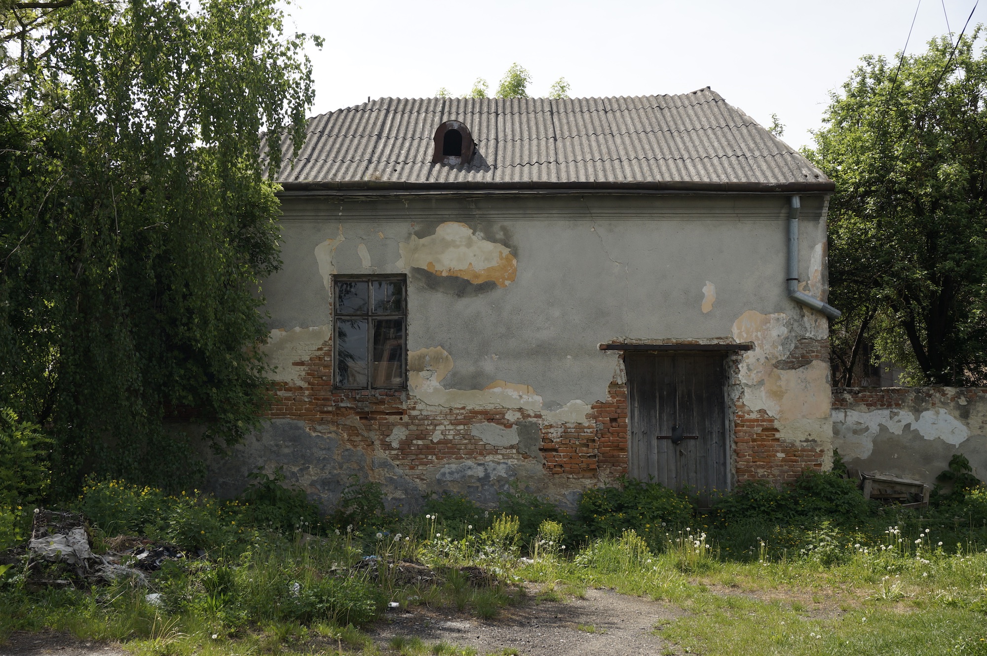
After WWII, for some years the building served as local student housing, and then a bakery; today the building is privately owned but unused as it is in need of significant structural repair. The current condition of the building does not support any regular use apart from storage or as an unsheltered workshop; see our report from October 2011.
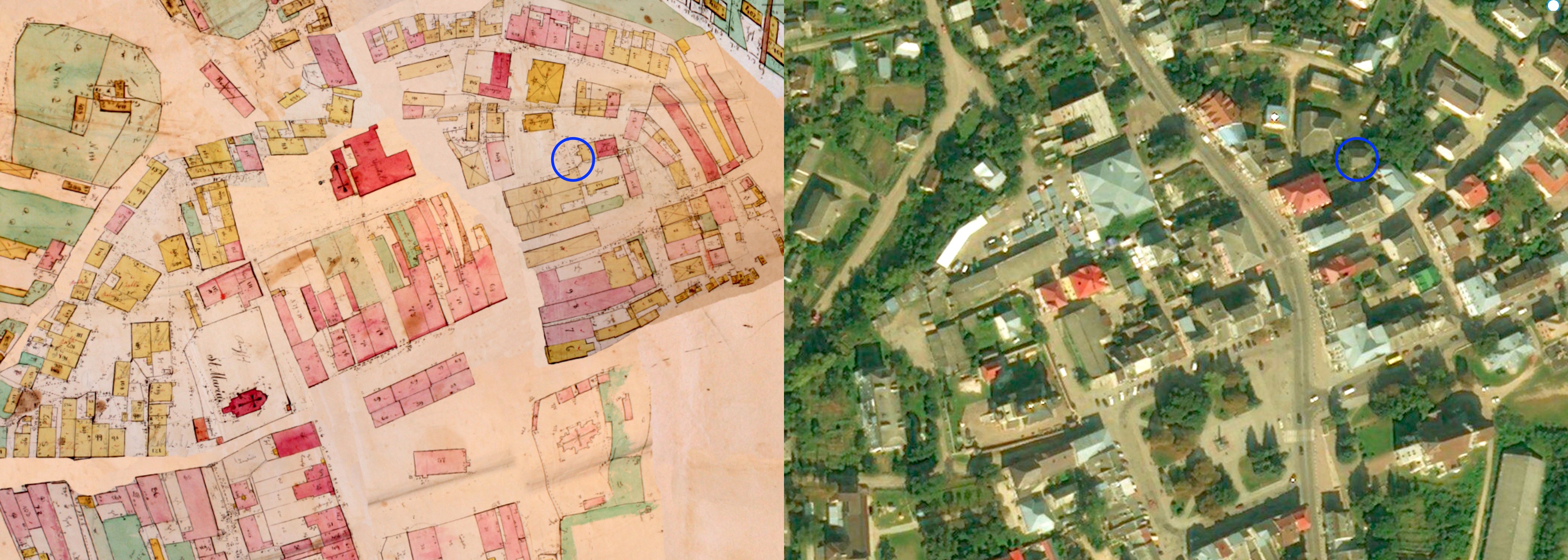
The Beit Midrash (blue circle) located on an 1846 cadastral sketch of Rohatyn, and on a modern satellite image with the same bounds.
Historical map courtesy of Gesher Galicia; satellite view © 2019 Microsoft Corporation, DigitalGlobe, and CNES.
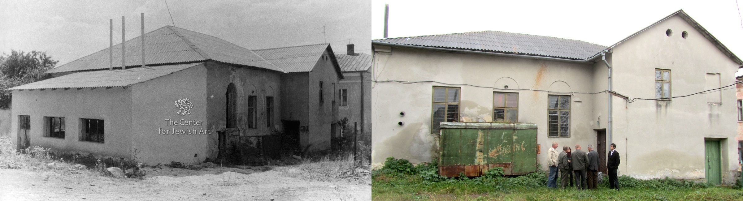
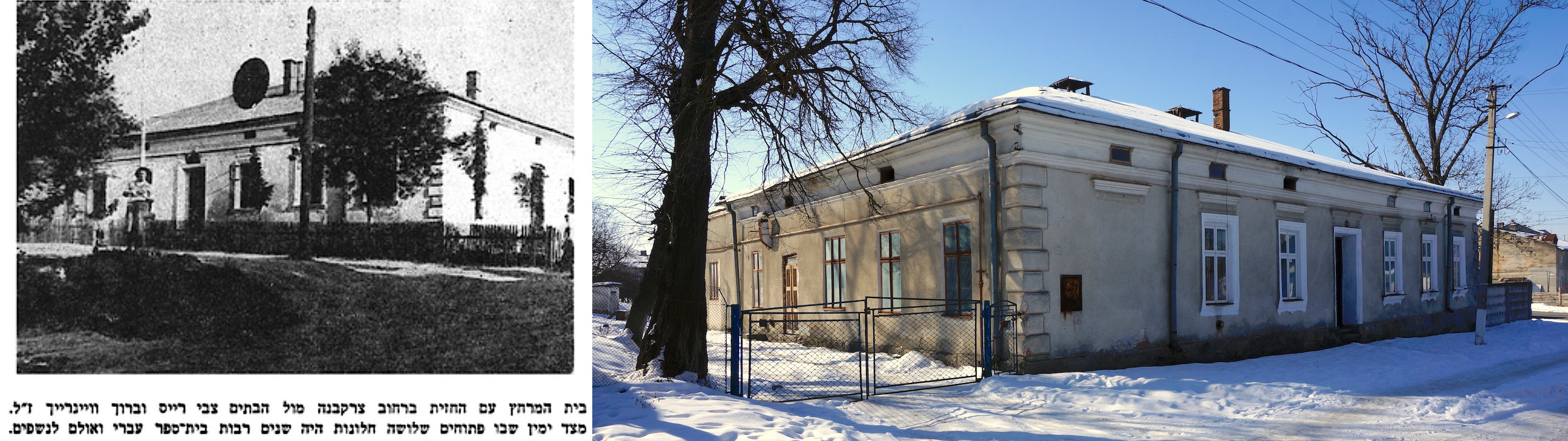
The beit midrash building exterior, in 1994 (photo © the Center for Jewish Art) and 2011 (photo © RJH).
The remains of interior wall murals in the largest room of the building were photographed in 1994 by Укрзахідпроектреставрація (Ukrzakhidproektrestavratsia, the West Ukrainian Institute for Conservation in Lviv) for the Center for Jewish Art at the Hebrew University of Jerusalem. As part of its Catalogue of Wall Paintings in Central and East European Synagogues, the Center has documented more than a dozen synagogues in Ukraine with images of their murals. Rohatyn’s beit midrash is included with 1 exterior and 9 interior photographs. A selection of those photos is included here:

Wall murals in the Rohatyn beit midrash, in 1994. Photos © the Center for Jewish Art. Click to enlarge.
The photographs, even though black & white, give a strong clue to the themes and style of the mural paintings. Painted architectural elements of columns and temples alternate with depictions of draperies, tassels, and urns; the foreground features are set against a backdrop of Mediterranean or Middle Eastern vegetation (palms), probably representing the Holy Land, perhaps Jerusalem. It appears that the murals covered all four walls, including between, above, and below the arched windows on the exterior walls. The ceiling in this room may also have been painted at one time; it’s not possible to tell from the 1994 photos. Other rooms in the building were not documented at the time.
Comparing the images from 1994 by the Center for Jewish Art with our own photos from 2011, it is clear that after 1994 the interior walls were whitewashed, though the remnants of the original murals are probably still under the white paint; we were told about the murals at the time of our visit, and some shadowy features may be seen on the walls:
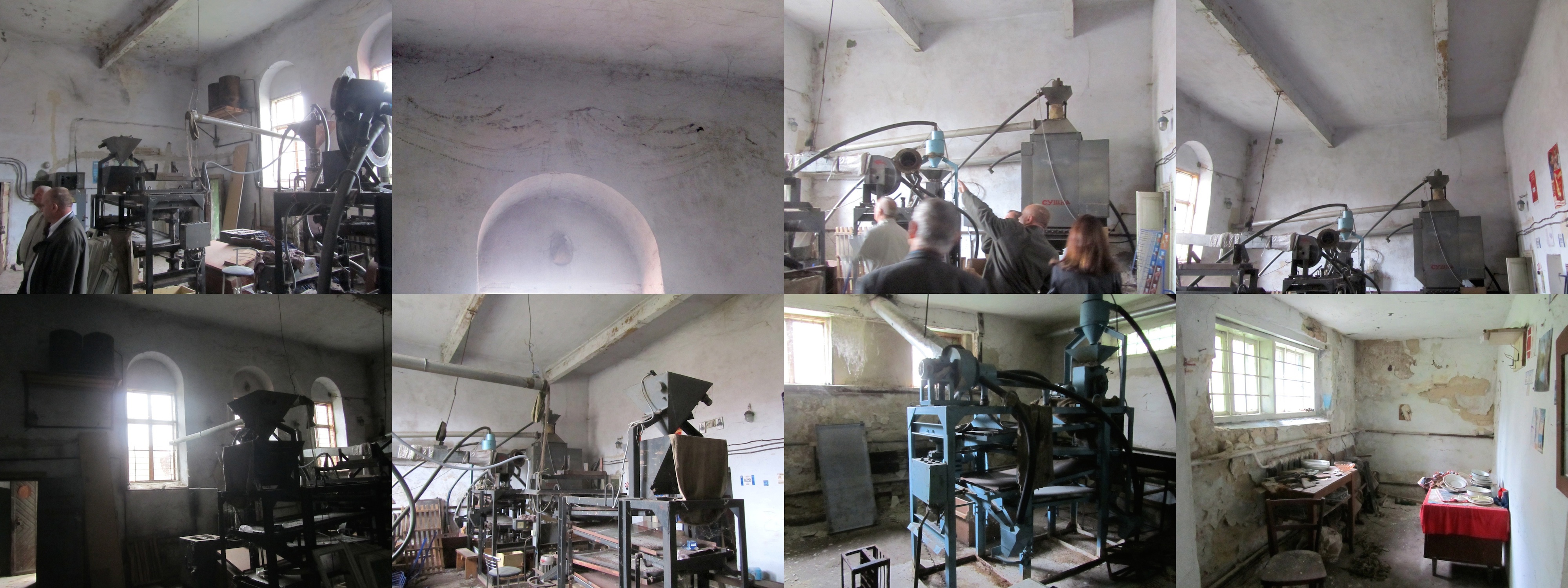
The interior of the Rohatyn beit midrash building in 2011. Photos © RJH.
A Small Synagogue or Cheder (Valova Street – ruin)
The small synagogue or cheder building on Valova Street. Photo © 2018 RJH.
The Center for Jewish Art (CJA) at the Hebrew University of Jerusalem has undertaken a large project to research and document Jewish visual art in all forms, including ritual architecture; the Center’s documentation is archived in an online database named for its founder, the Bezalel Narkiss Index of Jewish Art. Part of that database includes a growing collection of materials on historic synagogues of Europe, based on collaborative research from the 1990s to the present day. Among the documented religious community buildings is a small, partially ruined building adjacent to Rohatyn’s lost Great Synagogue described above and the main beit midrash building described below, in the once predominantly Jewish neighborhood northeast of the town square.
The CJA documentation for this building describes it as a former synagogue. The Center for Urban History of East Central Europe in Lviv, which worked with the CJA on the project and provided the images, included this building in their research and documentation project surveying surviving synagogues in the Ukrainian half of former Galicia; their researchers have speculated based on the building’s size and location that it may have been a small school, perhaps a cheder (religious school for young boys). It may also have served both purposes, as small prayer houses and religious schools often share the same spaces.
In the 1846 Rohatyn cadastral map and modern satellite sections shown below, the location of this building is circled in blue; it does not appear likely that the synagogue or cheder is one of the buildings standing in 1846, so we guess the CJA is correct in its estimate that it was built later (perhaps around 1900 based on architectural style). Today the building is structurally damaged, and serves only for storage. Further research is needed in order to discover additional information about this building.
The small synagogue or cheder (blue circle) located on an 1846 cadastral sketch of Rohatyn, and on a modern satellite image with the same bounds. Historical map courtesy of Gesher Galicia; satellite view © 2019 Microsoft Corporation, DigitalGlobe, and CNES.
The Western Synagogue and Mikveh (Kotsiubynskoho Street – repurposed)
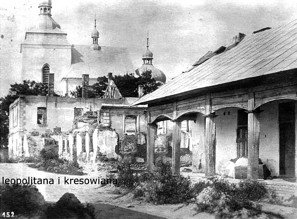
What is probably the ruin (later repaired) of the western synagogue, at left in front of Rohatyn’s UGC Church of the Nativity of the Mother of God. WWI-era image from the Facebook group Leopolitana i kresowiana, via Tetiana Petriv.
The Center for Urban History has also documented a former synagogue west of the Rohatyn town square on Kotsiubynskoho Street; this building and probably also its associated mikveh (ritual bath) have been incorporated into the Rohatyn internat (boarding school), where today they serve as a theater and laundry room, respectively; a few photos were published in our report from June 2011. The Center’s documentation includes a large number of photos from 2011 and an architectural plan of the current building, including plans and profiles of the ground floor and the upper floor. As seen below, a wooden synagogue preceding the current masonry structure is shown at the same location on the 1846 cadastral map of Rohatyn, in what must have been one of several Jewish neighborhoods in town in the 19th century.
The former western synagogue complex serves the Rohatyn internat and is cared for by that institution, which means the building is well maintained. The executive director of the internat has always been very open and informative with us and others about the building’s former use as a religious center for the Jewish community, and interested in any data we and others may be able to share with the school. During building renovation work at the facility in 2011, paper scraps were found by workers in the walls of the old structure; based on visible dates and the languages printed and written on them, the scraps had likely accumulated in the building during World War II. A few of the scraps were in Polish and German, but the vast majority of the more than 50 items were in Hebrew and Yiddish, including religious research and discussion, textbooks, business receipts, pages from prayer books, personal letters, and a postcard. One item was stamped for use by the Rohatyn Judenrat in the Jewish ghetto during the German occupation. The internat director shared his findings with us in spring of 2011, then donated the collection to the museum at Hesed Arieh in Lviv later that year; the papers were returned to Rohatyn for preservation and study when the Rohatyn Opillya local history museum was established in 2018.
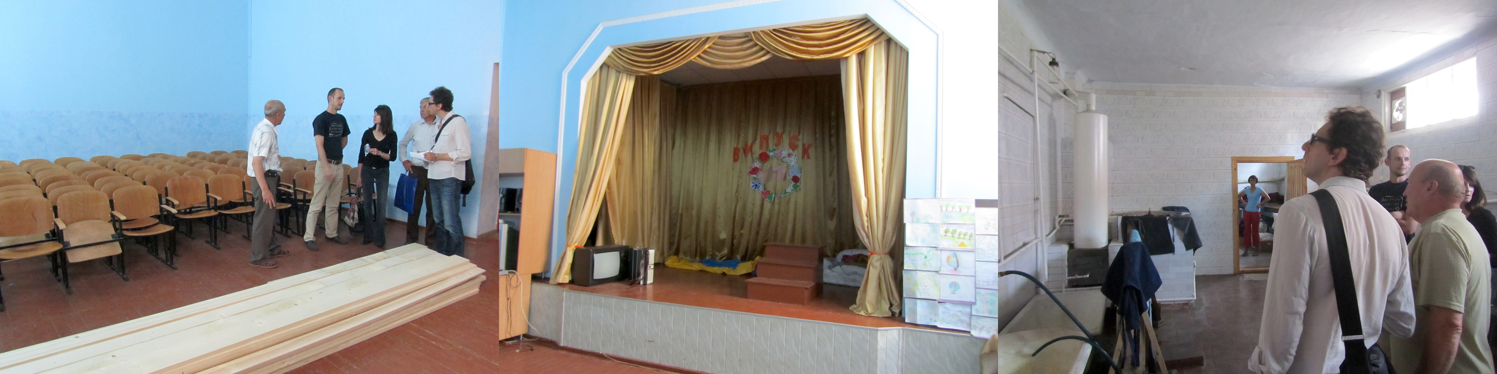
Inside the former western synagogue (left and center) and mikveh (right) with the director of the Rohatyn internat. Photos © 2011 RJH.
The western synagogue (blue circle) located on an 1846 cadastral sketch of Rohatyn, and on a modern satellite image with the same bounds.
Historical map courtesy of Gesher Galicia; satellite view © 2019 Microsoft Corporation, DigitalGlobe, and CNES.
A Former Bath House and Hebrew Language School (Kotsiubynskoho Street – repurposed)
Two views of the bath house: a pre-war photo from the Rohatyn Yizkor Book (p.137), and a current image (© 2018 RJH).
West of the town center and not far from the synagogue and mikveh described above, another bath house used by the Jewish community has been documented both in the Yizkor Book for Rohatyn and in the personal memoir of Jack Glotzer, a young Jewish man who lived across the street from the bath house before World War II. In the Yizkor Book, the caption accompanying a pre-war photo of the building describes it as a bath house with steam room, and says that earlier the building had included a Hebrew language school and a Jewish assembly hall. Glotzer refers to the building as “the municipal bath house (Łaźnia)” which suggests that by the mid 1930s the building was not exclusively Jewish and may have had no community religious function.
The building is not shown on the 1846 cadastral map, so must have been built later. The structure appears to be still in good condition, built of brick in a style from the first half of the 20th century. The current use of the building is unknown, and it is also not known if the interior retains any features to indicate its former use by the Jewish community.
Other Jewish Community Buildings
The 1846 cadastral map of Rohatyn shows at least six buildings with known or likely religious function connected to the Jewish community (circled in green on the image here), and which no longer exist. We don’t know exactly how many of those were destroyed when all of Rohatyn was heavily damaged in World War I, or how many others may have been built in the 90+ years between the 1846 cadastral survey and the onset of World War II. Today the empty spaces in what had been a densely-built area of Rohatyn are a reminder of the lost Jewish synagogues, schools, and bath houses which once stood there, and the past significance of this area to the Jewish religious community.
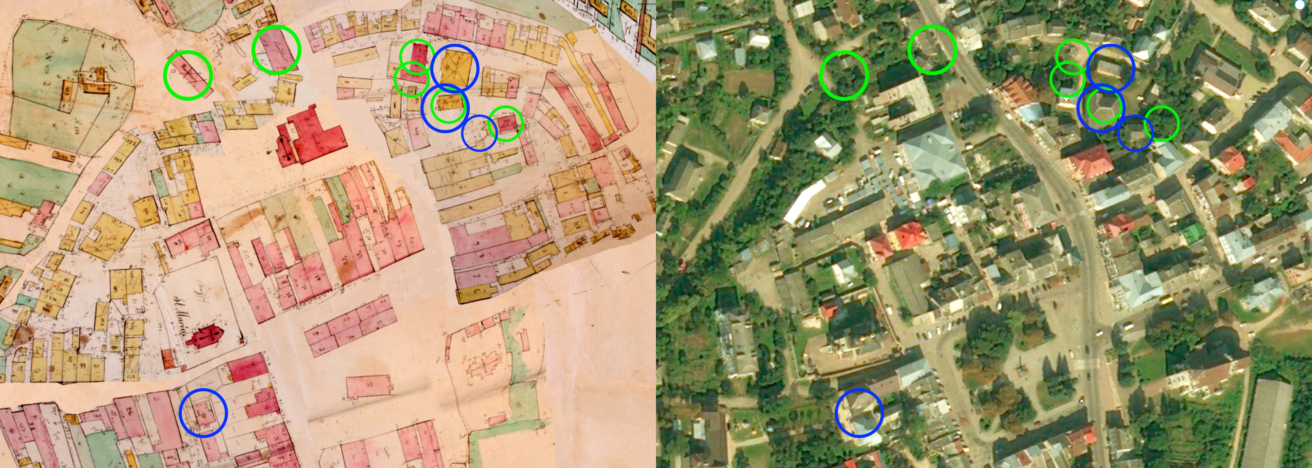
Surviving or vestigial Jewish community buildings (blue circles) located together with other recorded but now missing known or likely Jewish buildings (green circles)
on an 1846 cadastral sketch of Rohatyn, and on a modern satellite image with the same bounds.
Historical map courtesy of Gesher Galicia; satellite view © 2019 Microsoft Corporation, DigitalGlobe, and CNES.
Information about the building of the former Judenrat (local Jewish council under German authority during the occupation of World War II) still standing in Rohatyn appears on the heritage page for sites of the Shoah.
Other buildings which are only partially documented include:
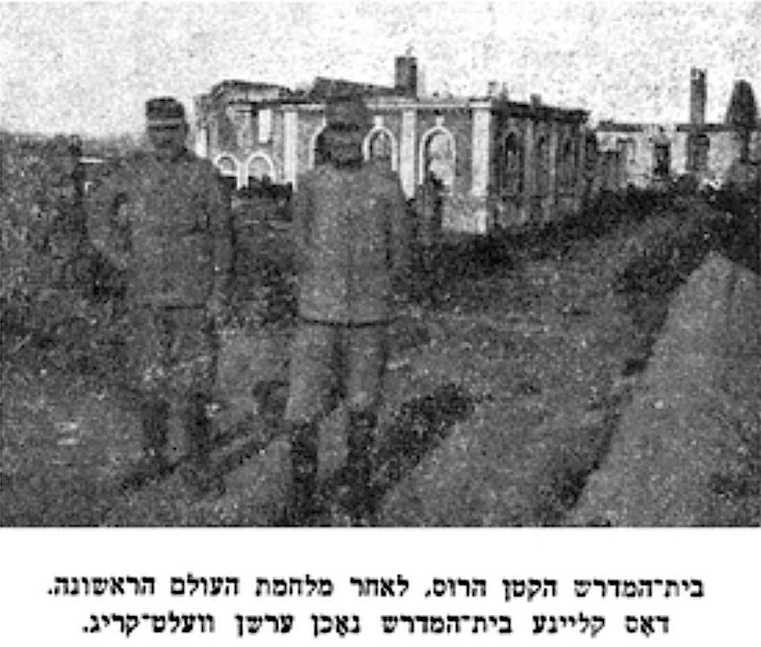
The Russian beit midrash as seen in the Rohatyn Yizkor Book (p.120).
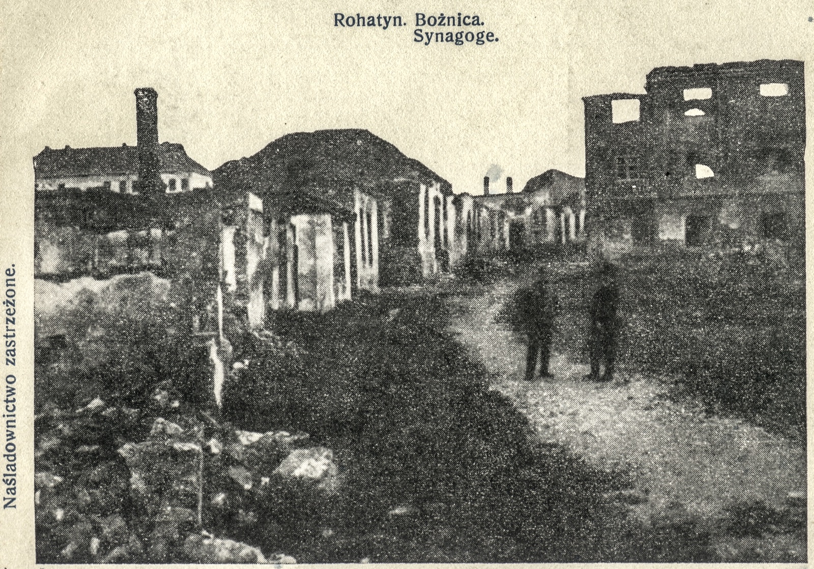
The “Russian” beit midrash: Although we have no information about this Jewish religious study center, or why it was labeled “Russian”, there is a blurred photograph of the building behind two soldiers during World War I with only a caption in the Yizkor Book for Rohatyn; in the same photograph, one can also see the damaged Great Synagogue and a portion of the damaged large beit midrash (both described above), so the location of the smaller Russian beit midrash is clear next to those significant structures.

A WWI-era view of the damaged religious center of Rohatyn (at right rear). Source: Tomasz Wiśniewski Collection.
Another WWI-era photograph of Rohatyn north and east of the town square, probably taken from the tower of the Roman Catholic church, shows a broad view of the extensive damage to the town’s architecture, including the old Jewish neighborhood on Valova Street and its collection of synagogues and other Jewish religious buildings. Clearly visible in this photograph is the Russian beit midrash just to the left and slightly behind the larger beit midrash; the heavily-damaged Great Synagogue is visible but largely obstructed by the large beit midrash. No trace of this former study hall remains today in the old Jewish neighborhood on Valova Street.
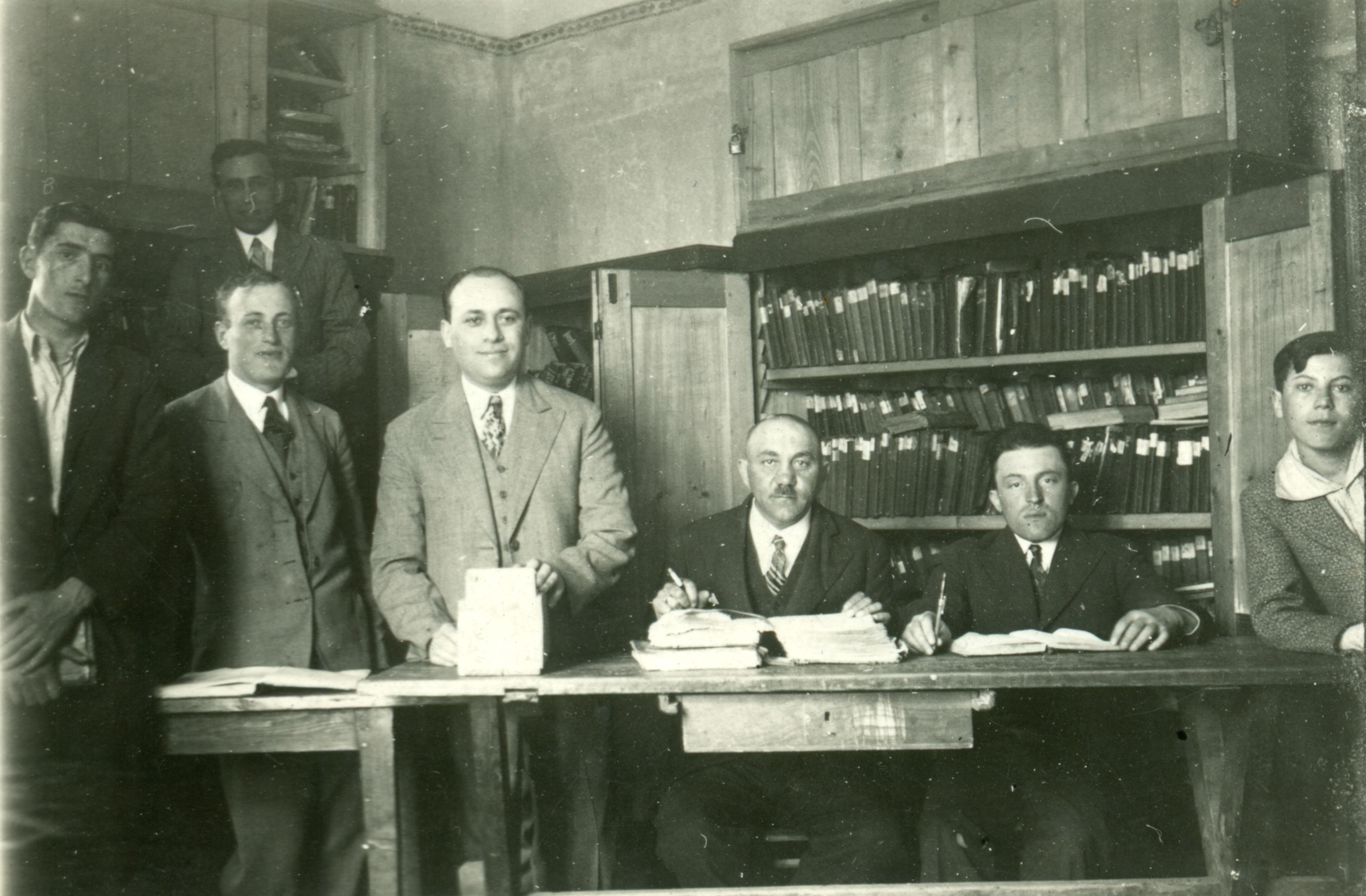
The library of Eretz Yisrael Verein, ca. 1930s. Source: Steinmetz Family Collection.
The library of the “Society for Israel”: Also pictured in the Yizkor Book for Rohatyn (p.110), but not yet located in town, was a library which served the Zionist social organization Eretz Yisrael Verein (“Society for Israel”), the photo is also preserved in the collections of a number of Rohatyn Jewish descendants. The names of those in the photo are recorded in the Yizkor Book, but without other details of the library, its contents, or its function – and nothing about its location. The picture is compelling, in part because a large number of labeled volumes are visible behind the men, as are cabinets and wall decor in the room.
Documentation about the now-lost Jewish community buildings in town remains scarce. We will publish or link here any useful information we can confirm, as our research continues.