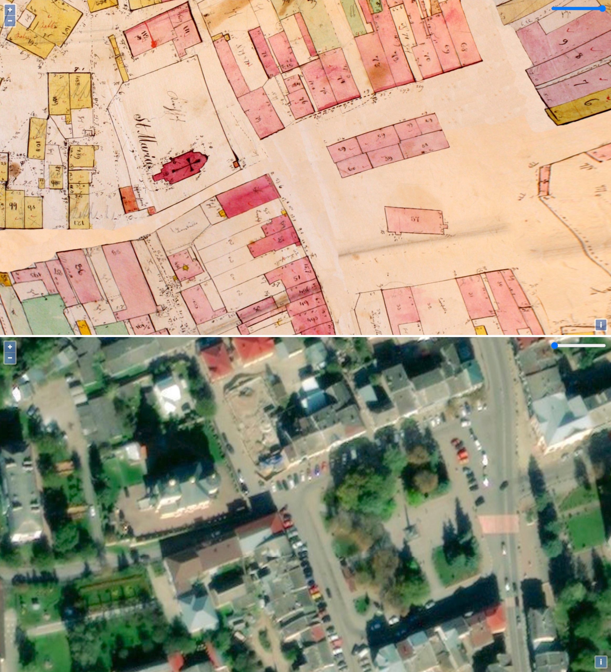
Two views of the map overlay: the georectified 1846 cadastral sketch (top), and the satellite image (bottom). Both views show a portion of the town square and the St. Mary church.
Two views of the map overlay
Two views of the map overlay: the georectified 1846 cadastral sketch (top), and the satellite image (bottom). Both views show a portion of the town square and the St. Mary church.
Two views of the map overlay